Photos that contain Exif data, are easily read by The Civil Nodes. All Exif data can be requested from the photo. Also the location is available with just a single node. The Lat/Lon is automatically converted to your Drawing’s Coordinate System.
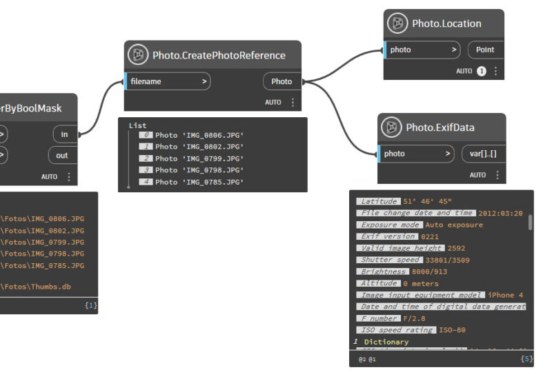
With all this data, the image and the location, it is easy to create drawings or tables with all you want to show, and use the Exif data to find out where the photo was taken.