The Civil 3D category contains several handy nodes for manipulating, creating or examinating Civil 3D objects. Get Alignments by type, get the Dynamo geometry of one, get all Profiles or Profile Views that are connected to an Alignment or create a Layout or Surface Profile.
Cogo Points can be created or the User Defined Properties can be read. Creating a group is as easy as creating one Cogo Point.
Link, Point or Shape Codes of a Corridor are easy to find, or all Corridor Surfaces. Also Corridor FeatureLines and as Offset Corridor FeatureLines.
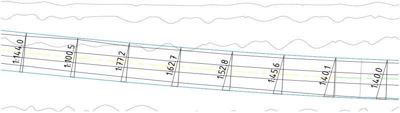
Surface Elevation Analysis is possible. Name your colors and it will create a range.
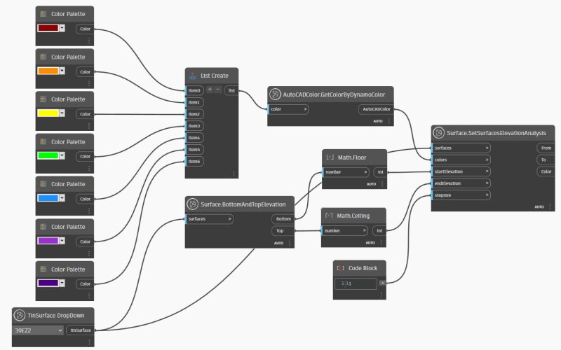
Result in:

FeatureLines are covered very well. You can access all FeatureLines or by name, you can get the Dynamo geometry or other properties. The same counts for Parcels. And Profiles. The Dynamo geometry of a Profile is a combination of the elevation along the Alignment.

The properties of Profile Views can be read, and from Surfaces too.
It is also very easy to place Spot Elevation Labels or Slope Labels on a Surface.
Sites can return all Alignments, FeatureLines or Parcels that belong to one.