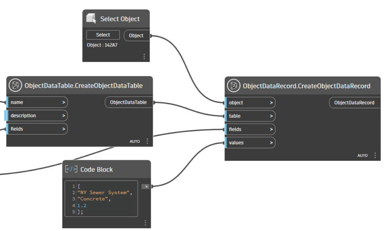
In Civil 3D it is possible to add extended data to objects with Property Sets, but because AutoCAD Map 3D is a base application inside Civil 3D, it is also possible to use Object Data. A few nodes are needed to create Object Data Tables, and add the Table with the field values to objects.
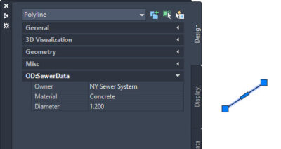
The Object Data is visible (and editable) in the Properties Palette.
In Civil 3D it is easy to export objects and the Object Data to GIS export formats like GML, Esri Shape, and many more.