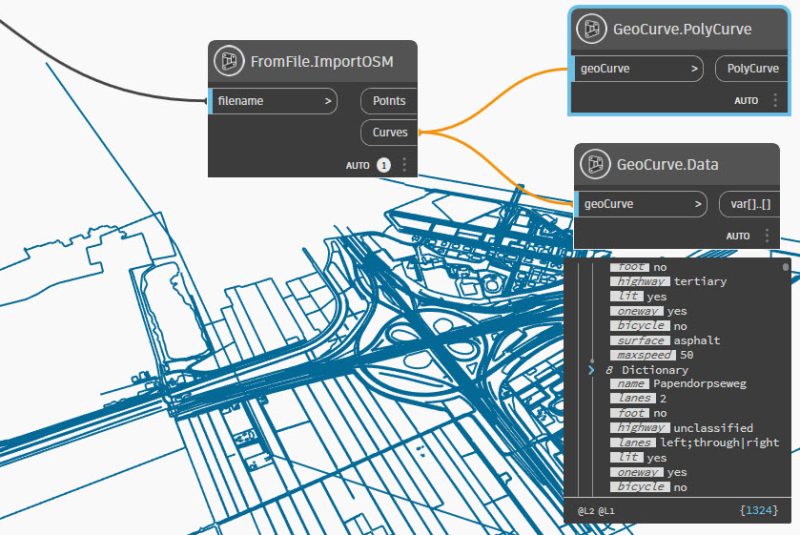
Downloaded Open Streetmap files (OSM) or Google Earth files (KML) contain geometry and data. With the Arkance Systems Node Library for Civil 3D Dynamo you can convert te geometry and data to Dynamo and from there to Civil 3D. You can use fields from the data to determine the layername, or color, or text notes.