Colorized AHN Point Clouds in Civil 3D en in QGIS CAD, GIS Colorized AHN Point Clouds in Civil 3D en in QGIS In een recente blog is wat verteld over de [...] Anton2022-11-21T22:01:10+01:0004-02-2023|Categorieën: CAD, GIS|Tags: AHN, Civil 3D, gestuurde boring, luchtfoto, Point Cloud, QGIS|Reacties uitgeschakeld voor Colorized AHN Point Clouds in Civil 3D en in QGIS Lees meer
Hoge resolutie luchtfoto 2021 CAD, GIS Hoge resolutie luchtfoto 2021 
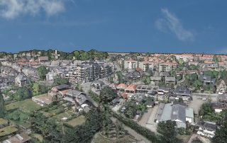
PDOK levert al geruime tijd de landsdekkende luchtfoto van [...] Anton2021-12-08T14:20:01+01:0022-12-2021|Categorieën: CAD, GIS|Tags: hoge resolutie, InfraCAD Map, luchtfoto, PDOK|Reacties uitgeschakeld voor Hoge resolutie luchtfoto 2021 Lees meer